
Topografische Karte El Gilf El Kebir Plateau
Interaktive Karte
Klicken Sie auf die Karte, um die Höhe anzuzeigen.
Über diese Karte
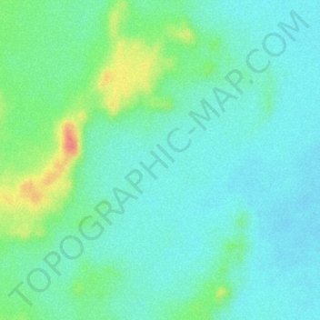
Name: Topografische Karte El Gilf El Kebir Plateau, Höhe, Relief.
Ort: El Gilf El Kebir Plateau, New Valley Governorate, Egypt (23.38046 26.08927 23.40046 26.10927)
Durchschnittliche Höhe: 1.037 m
Minimale Höhe: 1.017 m
Maximale Höhe: 1.088 m
Andere topografische Karten
Klicken Sie auf eine Karte, um ihre Topografie, ihre Höhe und ihr Relief anzuzeigen.
Rashida
Egypt > New Valley Governorate > Rashida
Rashida, New Valley Governorate, Egypt
Durchschnittliche Höhe: 101 m
El Dakhla Oasis
Egypt > New Valley Governorate > El Dakhla Oasis
El Dakhla Oasis, New Valley Governorate, Egypt
Durchschnittliche Höhe: 205 m
Al-Farafra
Egypt > New Valley Governorate > Al-Farafra
Al-Farafra, New Valley Governorate, Egypt
Durchschnittliche Höhe: 73 m
Al Izziyah
Egypt > New Valley Governorate > Al Izziyah
Al Izziyah, New Valley Governorate, Egypt
Durchschnittliche Höhe: 68 m
Aulad Salama
Egypt > New Valley Governorate > Aulad Salama
Aulad Salama, New Valley Governorate, Egypt
Durchschnittliche Höhe: 72 m
Dayr al Abyad
Egypt > New Valley Governorate
Dayr al Abyad, New Valley Governorate, Egypt
Durchschnittliche Höhe: 137 m
Hawd Dandarah
Egypt > New Valley Governorate > Al Ashraf al Bahriyah
Hawd Dandarah, Al Ashraf al Bahriyah, New Valley Governorate, Egypt
Durchschnittliche Höhe: 74 m