
Topografische Karte Carnegie
Interaktive Karte
Klicken Sie auf die Karte, um die Höhe anzuzeigen.
Über diese Karte
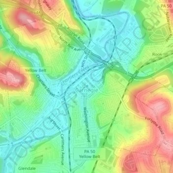
Name: Topografische Karte Carnegie, Höhe, Relief.
Durchschnittliche Höhe: 275 m
Minimale Höhe: 226 m
Maximale Höhe: 350 m
According to the United States Census Bureau, the borough has a total area of 1.6 square miles (4.1 km2), all of it land. Its average elevation is 833 ft (254 m) above sea level.