
Topografische Karte Izena
Interaktive Karte
Klicken Sie auf die Karte, um die Höhe anzuzeigen.
Über diese Karte
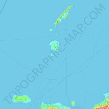
Name: Topografische Karte Izena, Höhe, Relief.
Ort: Izena, Shimajiri, Okinawa Prefecture, Japan (26.79814 127.64823 26.99760 128.13152)
Durchschnittliche Höhe: 3 m
Minimale Höhe: 0 m
Maximale Höhe: 335 m
The island's topography features a row of mountains spanning from the northwest to the southeast of the island, with generally flat, arable land covering the remainder. The island has several sandy beaches and designated camping areas with bathroom facilities. The view of Izena's rocky southern coastline is well known as one of Japan's best, with the rock formations 'Umi Gitara' and 'Agi Gitara' dramatically rising from the land and sea.
Andere topografische Karten
Klicken Sie auf eine Karte, um ihre Topografie, ihre Höhe und ihr Relief anzuzeigen.