
Topografische Karte Levoča
Interaktive Karte
Klicken Sie auf die Karte, um die Höhe anzuzeigen.
Levoča
The economic importance of the town was further diminished in 1871 when the important new Košice–Bohumín Railway was built just 8 km (5.0 mi) to the south, bypassing Levoča and going through the nearby town of Spišská Nová Ves. Later, in 1892, only a spur line was built from Spišská Nová Ves railway station to Levoča. Erwin Raisz, a famed cartographer who immigrated to the United States after earning a degree in engineering and architecture from the University of Hungary and after serving in WWI, was born in Levoča in 1893. Raisz learned about map making from his father, also a civil engineer, and was no doubt inspired by the topography of his homeland to create a unique hand-drawn method of portraying physiographic features. He taught at Harvard University and wrote the first cartography textbook in English.
Über diese Karte
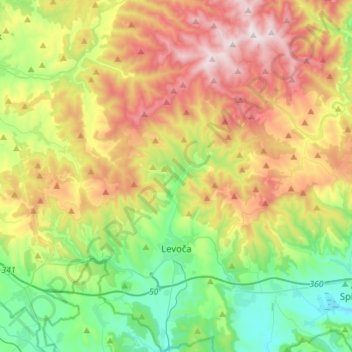
Name: Topografische Karte Levoča, Höhe, Relief.
Durchschnittliche Höhe: 745 m
Minimale Höhe: 425 m
Maximale Höhe: 1.238 m