
Topografische Karte Lake of the Clouds
Interaktive Karte
Klicken Sie auf die Karte, um die Höhe anzuzeigen.
Über diese Karte
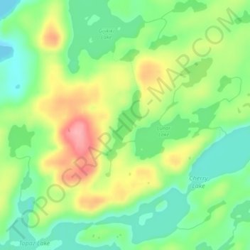
Name: Topografische Karte Lake of the Clouds, Höhe, Relief.
Ort: Lake of the Clouds, Lake County, Minnesota, United States (48.13859 -91.11538 48.14624 -91.10964)
Durchschnittliche Höhe: 466 m
Minimale Höhe: 421 m
Maximale Höhe: 531 m
Andere topografische Karten
Klicken Sie auf eine Karte, um ihre Topografie, ihre Höhe und ihr Relief anzuzeigen.
Silver Bay
United States > Minnesota > Lake County
Silver Bay, Lake County, Minnesota, 55614, United States
Durchschnittliche Höhe: 247 m
Hum Lake
United States > Minnesota > Lake County
Hum Lake, Lake County, Minnesota, United States
Durchschnittliche Höhe: 468 m
Castle Danger
United States > Minnesota > Lake County
Castle Danger, Lake County, Minnesota, United States
Durchschnittliche Höhe: 212 m
Garden Lake
United States > Minnesota > Lake County
Garden Lake, Lake County, Minnesota, United States
Durchschnittliche Höhe: 426 m
Griddle Lake
United States > Minnesota > Lake County
Griddle Lake, Lake County, Minnesota, United States
Durchschnittliche Höhe: 444 m
Silver Bay
United States > Minnesota > Lake County > Silver Bay > Silver Bay
Silver Bay, Lake County, Minnesota, 55614, United States
Durchschnittliche Höhe: 256 m
Bow Lake
United States > Minnesota > Lake County
Bow Lake, Lake County, Minnesota, United States
Durchschnittliche Höhe: 477 m
Beaver Bay
United States > Minnesota > Lake County
Beaver Bay, Lake County, Minnesota, 55601, United States
Durchschnittliche Höhe: 212 m
Two Harbors
United States > Minnesota > Lake County
Two Harbors, Lake County, Minnesota, United States
Durchschnittliche Höhe: 221 m
Gull Lake
United States > Minnesota > Lake County
Gull Lake, Lake County, Minnesota, United States
Durchschnittliche Höhe: 467 m