
Topografische Karte Village of Cayuga Heights
Interaktive Karte
Klicken Sie auf die Karte, um die Höhe anzuzeigen.
Village of Cayuga Heights
Cayuga Heights is located at 42°27′59″N 76°29′19″W / 42.466338°N 76.488678°W / 42.466338; -76.488678 (42.466338, -76.488678), on the eastern slope of Cayuga Lake. The elevation ranges from 900 feet near the Community Corners to 400 feet near the lake. Several streams and steep gorges cut through the village.
Über diese Karte
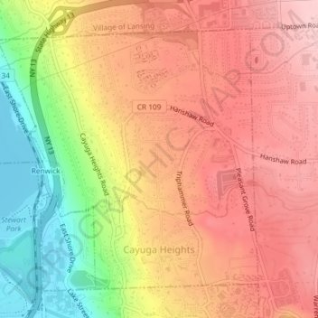
Name: Topografische Karte Village of Cayuga Heights, Höhe, Relief.
Durchschnittliche Höhe: 234 m
Minimale Höhe: 114 m
Maximale Höhe: 311 m
Andere topografische Karten
Klicken Sie auf eine Karte, um ihre Topografie, ihre Höhe und ihr Relief anzuzeigen.
Hayts Corner
United States > New York > Tompkins County > Town of Ithaca
Durchschnittliche Höhe: 256 m