
Topografische Karte Bombay Beach
Interaktive Karte
Klicken Sie auf die Karte, um die Höhe anzuzeigen.
Über diese Karte
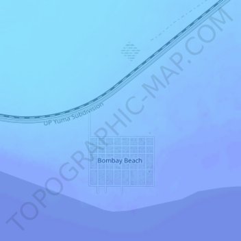
Name: Topografische Karte Bombay Beach, Höhe, Relief.
Durchschnittliche Höhe: -61 m
Minimale Höhe: -71 m
Maximale Höhe: -29 m
Andere topografische Karten
Klicken Sie auf eine Karte, um ihre Topografie, ihre Höhe und ihr Relief anzuzeigen.
Brawley
États-Unis d'Amérique > Californie > Imperial County
Brawley, Imperial County, Californie, 92227, États-Unis d'Amérique
Durchschnittliche Höhe: -36 m
El Centro
États-Unis d'Amérique > Californie > Imperial County
El Centro, Imperial County, Californie, 92243, États-Unis d'Amérique
Durchschnittliche Höhe: -10 m
Andrade
États-Unis d'Amérique > Californie > Imperial County
Andrade, Imperial County, Californie, 93383, États-Unis d'Amérique
Durchschnittliche Höhe: 55 m
Niland
États-Unis d'Amérique > Californie > Imperial County > Niland
Niland, Imperial County, Californie, États-Unis d'Amérique
Durchschnittliche Höhe: -40 m
Calexico
États-Unis d'Amérique > Californie > Imperial County
Calexico, Imperial County, Californie, 92231, États-Unis d'Amérique
Durchschnittliche Höhe: 2 m