

Topografische Karte Loch Tay
Klicken Sie auf die Karte, um die Höhe anzuzeigen.
Loch Tay
In the Early Medieval period people began to cultivate the higher elevations of the hills around the loch. The Macnabs, the Menzies, the Drummonds, the Napiers, the Haldanes, the MacGregors and the Robertsons of Carwhin and Strowan all owned land around the loch but little remains of their possible castles/manoors. Most of the surviving lordly residences are associated with the Glenorchy Campbells, who grew in power and influence during the 15th and early 16th centuries, specifically those at Lawers, Carwhin and Edramucky.
Über diese Karte
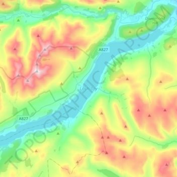
Name: Topografische Karte Loch Tay, Höhe, Relief.
Ort: Loch Tay, Kenmore, Perth and Kinross, Scotland, United Kingdom (56.46929 -4.30815 56.58625 -3.99615)
Durchschnittliche Höhe: 460 m
Minimale Höhe: 93 m
Maximale Höhe: 1.204 m