Topografische Karte Bonvilston
Klicken Sie auf die Karte, um die Höhe anzuzeigen.
Bonvilston
In the 19th century, Richard Bassett, a prominent figure in Glamorgan resided at Bonvilston House and owned the manor. The 1811 A Topographical Dictionary of The Dominion of Wales by Nicholas Carlisle said of the village.
Über diese Karte
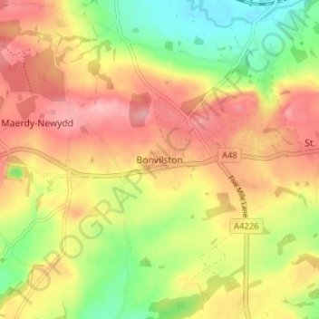
Name: Topografische Karte Bonvilston, Höhe, Relief.
Ort: Bonvilston, Vale of Glamorgan, Wales, CF5 6TY, United Kingdom (51.43855 -3.36566 51.47855 -3.32566)
Durchschnittliche Höhe: 83 m
Minimale Höhe: 17 m
Maximale Höhe: 138 m
Andere topografische Karten
Klicken Sie auf eine Karte, um ihre Topografie, ihre Höhe und ihr Relief anzuzeigen.



River Ely
United Kingdom > Wales > Vale of Glamorgan > Peterston-super-Ely
Durchschnittliche Höhe: 109 m
Cosmeston Lakes Country Park
United Kingdom > Wales > Vale of Glamorgan > Penarth
Durchschnittliche Höhe: 26 m