
Topografische Karte Nevado Mismi
Interaktive Karte
Klicken Sie auf die Karte, um die Höhe anzuzeigen.
Über diese Karte
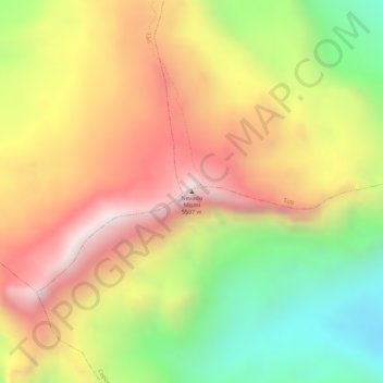
Name: Topografische Karte Nevado Mismi, Höhe, Relief.
Durchschnittliche Höhe: 5.260 m
Minimale Höhe: 4.863 m
Maximale Höhe: 5.589 m
The Upper Amazon expedition (The Flying Expedition) included an Eastern European multi-axled articulated Land Rover for use on land, a float plane Papagaiu, for air support and reconnaissance, and the Peruvian Air Force offered a high elevation helicopter to reach the upper levels of the Chila mountain range in Peru.