Geolokalisieren

Topografische Karte Asana

Interaktive Karte

Klicken Sie auf die Karte, um die Höhe anzuzeigen.

Über diese Karte

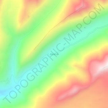
Name: Topografische Karte Asana, Höhe, Relief.

Ort: Asana, Torata, Province of Mariscal Nieto, Moquegua, Peru (-17.08150 -70.54128 -17.04150 -70.50128)

Durchschnittliche Höhe: 4.638 m

Minimale Höhe: 4.266 m

Maximale Höhe: 5.092 m

Andere topografische Karten

Klicken Sie auf eine Karte, um ihre Topografie, ihre Höhe und ihr Relief anzuzeigen.

Calientes

Peru > Moquegua

Calientes, Torata, Province of Mariscal Nieto, Moquegua, Peru

Durchschnittliche Höhe: 3.040 m

Quellaveco

Peru > Moquegua

Quellaveco, Torata, Province of Mariscal Nieto, Moquegua, Peru

Durchschnittliche Höhe: 3.861 m

Yurac Kancha

Peru > Moquegua > Ubinas

Yurac Kancha, Ubinas, Province of General Sánchez Cerro, Moquegua, Peru

Durchschnittliche Höhe: 4.514 m

Toquepala Caves

Peru > Moquegua > Moquegua

Toquepala Caves, Carretera Moquegua - Toquepala, Moquegua, Province of Mariscal Nieto, Moquegua, Peru

Durchschnittliche Höhe: 2.258 m

Province of Ilo

Peru > Moquegua

Province of Ilo, Moquegua, Peru

Durchschnittliche Höhe: 652 m

Ilo

Peru > Moquegua > Ilo > Ilo

Ilo, Province of Ilo, Moquegua, 18601, Peru

Durchschnittliche Höhe: 74 m

Pasto Grande

Peru > Moquegua > Carumas

Pasto Grande, Carumas, Mariscal Nieto, Moquegua, Peru

Durchschnittliche Höhe: 4.550 m

Los Cerrillos

Peru > Moquegua > Los Cerrillos

Los Cerrillos, Mariscal Nieto, Moquegua, Peru

Durchschnittliche Höhe: 1.526 m

Ilo

Peru > Moquegua > Ilo

Ilo, Province of Ilo, Moquegua, 18601, Peru

Durchschnittliche Höhe: 108 m