
Topografische Karte Santa Ana
Interaktive Karte
Klicken Sie auf die Karte, um die Höhe anzuzeigen.
Über diese Karte
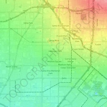
Name: Topografische Karte Santa Ana, Höhe, Relief.
Durchschnittliche Höhe: 30 m
Minimale Höhe: -1 m
Maximale Höhe: 80 m
Santa Ana is nested on flat, low-lying plains with little land elevation change. Running through the west end of the city is the mostly channelized Santa Ana River, which is also largely seasonal due to the construction of the Prado Dam and Seven Oaks Dam. The river has caused several severe floods in the 20th century, and is a continued threat despite the existence of the dams.