
Topografische Karte Blackford County
Interaktive Karte
Klicken Sie auf die Karte, um die Höhe anzuzeigen.
Über diese Karte
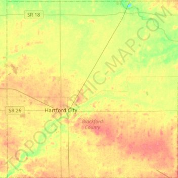
Name: Topografische Karte Blackford County, Höhe, Relief.
Ort: Blackford County, Indiana, USA (40.37886 -85.44538 40.56792 -85.20086)
Durchschnittliche Höhe: 274 m
Minimale Höhe: 246 m
Maximale Höhe: 296 m
Andere topografische Karten
Klicken Sie auf eine Karte, um ihre Topografie, ihre Höhe und ihr Relief anzuzeigen.
Zionsville
USA > Indiana > Zionsville
Zionsville, Boone County, Indiana, USA
Durchschnittliche Höhe: 273 m
Middle Fork of Wildcat Creek
Middle Fork of Wildcat Creek, Clinton County, Indiana, 46065, USA
Durchschnittliche Höhe: 215 m
Mount Etna
USA > Indiana > Mount Etna
Mount Etna, Huntington County, Indiana, USA
Durchschnittliche Höhe: 245 m
Bloomington
USA > Indiana > Bloomington
Bloomington, Monroe County, Indiana, USA
Durchschnittliche Höhe: 241 m