
Topografische Karte Bull Island
Interaktive Karte
Klicken Sie auf die Karte, um die Höhe anzuzeigen.
Über diese Karte
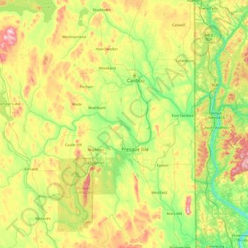
Name: Topografische Karte Bull Island, Höhe, Relief.
Durchschnittliche Höhe: 204 m
Minimale Höhe: 49 m
Maximale Höhe: 512 m
Andere topografische Karten
Klicken Sie auf eine Karte, um ihre Topografie, ihre Höhe und ihr Relief anzuzeigen.
Tory Hill
United States of America > Maine > Phillips
Tory Hill, Phillips, Franklin County, Maine, United States of America
Durchschnittliche Höhe: 398 m
West Jonesport
United States of America > Maine > Beals > West Jonesport
West Jonesport, Beals, Washington County, Maine, 04611, United States of America
Durchschnittliche Höhe: 6 m
Kennebec County
United States of America > Maine
Kennebec County, Maine, United States of America
Durchschnittliche Höhe: 98 m
Piscataquis County
United States of America > Maine
Piscataquis County, Maine, United States of America
Durchschnittliche Höhe: 310 m