
Topografische Karte North Glengarry
Interaktive Karte
Klicken Sie auf die Karte, um die Höhe anzuzeigen.
Über diese Karte
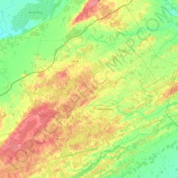
Name: Topografische Karte North Glengarry, Höhe, Relief.
Durchschnittliche Höhe: 78 m
Minimale Höhe: 44 m
Maximale Höhe: 128 m
Andere topografische Karten
Klicken Sie auf eine Karte, um ihre Topografie, ihre Höhe und ihr Relief anzuzeigen.
Morrisburg
Canada > Ontario > Stormont, Dundas and Glengarry Counties > South Dundas
Durchschnittliche Höhe: 79 m