
Topografische Karte Chautauqua County
Interaktive Karte
Klicken Sie auf die Karte, um die Höhe anzuzeigen.
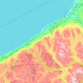
Chautauqua County
The county is generally composed of rolling hills and valleys, with elevations ranging anywhere between 1100 and 2100 feet, although the land within a few miles of Lake Erie is generally flat and at an elevation of 1000 feet or lower. The lowest point in the county is Lake Erie, at 571 feet (174 meters), and the highest point is Gurnsey Benchmark at 2180 feet (664 meters).
Über diese Karte
Name: Topografische Karte Chautauqua County, Höhe, Relief.
Ort: Chautauqua County, New York, United States of America (41.99833 -79.76194 42.69143 -79.06078)
Durchschnittliche Höhe: 328 m
Minimale Höhe: 170 m
Maximale Höhe: 668 m