
Topografische Karte Stakčín
Interaktive Karte
Klicken Sie auf die Karte, um die Höhe anzuzeigen.
Stakčín
The municipality lies in the Cirocha river valley, at an altitude of 257 metres and with a total area of 167.742 km2. According to the 2013 census it had a population of 2452 inhabitants. It lies between the Vihorlat and Bukovské vrchy mountains. The municipality is the seat of the Poloniny National Park governing body.
Über diese Karte
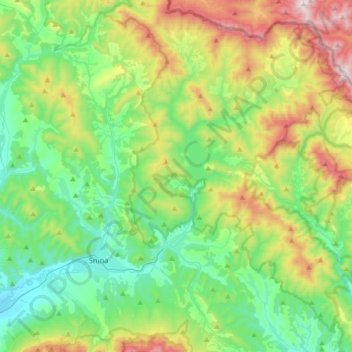
Name: Topografische Karte Stakčín, Höhe, Relief.
Durchschnittliche Höhe: 471 m
Minimale Höhe: 181 m
Maximale Höhe: 1.147 m
Andere topografische Karten
Klicken Sie auf eine Karte, um ihre Topografie, ihre Höhe und ihr Relief anzuzeigen.
Vyškov
Slovakia > Region of Prešov > District of Snina > Belá nad Cirochou
Durchschnittliche Höhe: 336 m