
Topografische Karte Brambuk - The National Park and Cultural Centre Park
Interaktive Karte
Klicken Sie auf die Karte, um die Höhe anzuzeigen.
Über diese Karte
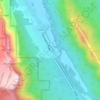
Name: Topografische Karte Brambuk - The National Park and Cultural Centre Park, Höhe, Relief.
Durchschnittliche Höhe: 372 m
Minimale Höhe: 223 m
Maximale Höhe: 732 m
Andere topografische Karten
Klicken Sie auf eine Karte, um ihre Topografie, ihre Höhe und ihr Relief anzuzeigen.
Boroka Lookout
Australia > Victoria > Halls Gap
Boroka Lookout, Boroka Track, Halls Gap, Shire of Northern Grampians, Victoria, 3381, Australia
Durchschnittliche Höhe: 614 m