
Topografische Karte Flüelapass
Interaktive Karte
Klicken Sie auf die Karte, um die Höhe anzuzeigen.
Flüelapass
The Flüela Pass (German: Flüelapass, Romansh: Pass dal Flüela, elevation 2,384 m (7,822 ft)) is a high mountain pass of the Swiss Alps in Graubünden. Traditionally considered the boundary between the Albula and Silvretta Alps, the pass crosses the watershed / drainage divide between the basins of the Rivers Rhine and Danube. The pass is overlooked by the Flüela Schwarzhorn (Albula Alps) and the Flüela Wisshorn (Silvretta Alps). The summit of the pass lies between the lakes Lai da la Scotta and Lai Nair.
Über diese Karte
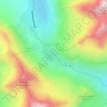
Name: Topografische Karte Flüelapass, Höhe, Relief.
Durchschnittliche Höhe: 2.568 m
Minimale Höhe: 2.225 m
Maximale Höhe: 3.064 m