
Topografische Karte Genesee
Interaktive Karte
Klicken Sie auf die Karte, um die Höhe anzuzeigen.
Genesee
Genesee is located at 46°33.0′N 116°55.5′W / 46.5500°N 116.9250°W / 46.5500; -116.9250 (46.5506, -116.9245)., at an elevation of 2,680 feet (817 m) above sea level. Located in the Palouse region, it is approximately 14 miles (23 km) south of Moscow, about halfway to Lewiston. The city center is just east of US-95, and just north of the Nez Perce County line in Sections 13 and 14 of Township 37 North, Range 5 West.
Über diese Karte
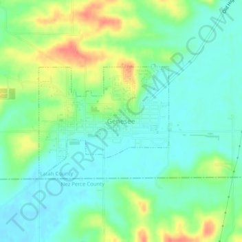
Name: Topografische Karte Genesee, Höhe, Relief.
Durchschnittliche Höhe: 824 m
Minimale Höhe: 805 m
Maximale Höhe: 859 m