
Topografische Karte West Cork
Interaktive Karte
Klicken Sie auf die Karte, um die Höhe anzuzeigen.
Über diese Karte
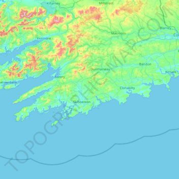
Name: Topografische Karte West Cork, Höhe, Relief.
Ort: West Cork, County Cork, Munster, Irland (51.38887 -10.30252 51.83673 -8.80738)
Durchschnittliche Höhe: 83 m
Minimale Höhe: 0 m
Maximale Höhe: 971 m
Andere topografische Karten
Klicken Sie auf eine Karte, um ihre Topografie, ihre Höhe und ihr Relief anzuzeigen.