
Topografische Karte Stormont, Dundas and Glengarry
Interaktive Karte
Klicken Sie auf die Karte, um die Höhe anzuzeigen.
Über diese Karte
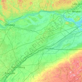
Name: Topografische Karte Stormont, Dundas and Glengarry, Höhe, Relief.
Durchschnittliche Höhe: 153 m
Minimale Höhe: 19 m
Maximale Höhe: 974 m
Andere topografische Karten
Klicken Sie auf eine Karte, um ihre Topografie, ihre Höhe und ihr Relief anzuzeigen.
Lac Saint-François
Canada > Ontario > Stormont, Dundas and Glengarry Counties > South Glengarry
Lac Saint-François, South Glengarry, Stormont, Dundas and Glengarry Counties, Est de l'Ontario, Ontario, J0P 1B0, Canada
Durchschnittliche Höhe: 116 m