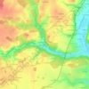
Topografische Karte Azay-le-Rideau
Klicken Sie auf die Karte, um die Höhe anzuzeigen.
Azay-le-Rideau
L'Indre, d'une longueur totale de 279,4 km, prend sa source à une altitude de 453 m sur le territoire de Saint-Priest-la-Marche dans le département du Cher et se jette dans la Loire à Avoine, après avoir traversé 58 communes. Les crues de l'Indre sont le plus souvent de type inondation de plaine. Sur le plan de la prévision des crues, la commune est située dans le tronçon de l'Indre tourangelle, dont la station hydrométrique de référence la plus proche est située à Monts. Le débit mensuel moyen (calculé sur 14 ans pour cette station) varie de 4,51 m3/s au mois de septembre à 34 m3/s au mois de février. Le débit instantané maximal observé sur cette station est de 236 m3/s le 2 juin 2016, la hauteur maximale relevée a été de 5,56 m ce même jour. Ce cours d'eau est classé dans les listes 1 et 2 au titre de l'article L. 214-17 du code de l'environnement sur le Bassin Loire-Bretagne. Au titre de la liste 1, aucune autorisation ou concession ne peut être accordée pour la construction de nouveaux ouvrages s'ils constituent un obstacle à la continuité écologique et le renouvellement de la concession ou de l'autorisation des ouvrages existants est subordonné à des prescriptions permettant de maintenir le très bon état écologique des eaux. Au titre de la liste 2, tout ouvrage doit être géré, entretenu et équipé selon des règles définies par l'autorité administrative, en concertation avec le propriétaire ou, à défaut, l'exploitant. Sur le plan piscicole, l'Indre est classée en deuxième catégorie piscicole. Le groupe biologique dominant est constitué essentiellement de poissons blancs (cyprinidés) et de carnassiers (brochet, sandre et perche).
Über diese Karte
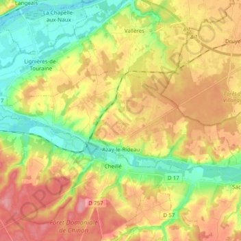
Name: Topografische Karte Azay-le-Rideau, Höhe, Relief.
Durchschnittliche Höhe: 79 m
Minimale Höhe: 33 m
Maximale Höhe: 127 m
Andere topografische Karten
Klicken Sie auf eine Karte, um ihre Topografie, ihre Höhe und ihr Relief anzuzeigen.

La Ville
France > Centre-Val de Loire > Indre-et-Loire > Chinon > La Ville
Durchschnittliche Höhe: 52 m

Mont Théodore
France > Centre-Val de Loire > Indre-et-Loire > Montlouis-sur-Loire
Durchschnittliche Höhe: 67 m
Saint-Sulpice
France > Centre-Val de Loire > Indre-et-Loire > Chambourg-sur-Indre
Durchschnittliche Höhe: 90 m

Nouy
France > Centre-Val de Loire > Indre-et-Loire > Saint-Martin-le-Beau
Durchschnittliche Höhe: 72 m


Les Regains
France > Centre-Val de Loire > Indre-et-Loire > Nazelles-Négron
Durchschnittliche Höhe: 76 m
Château de la Roche d'Alès
France > Centre-Val de Loire > Indre-et-Loire > Marray
Durchschnittliche Höhe: 122 m
Les Tanneries
France > Centre-Val de Loire > Indre-et-Loire > Sainte-Maure-de-Touraine
Durchschnittliche Höhe: 95 m
Le Bois Joly
France > Centre-Val de Loire > Indre-et-Loire > Tauxigny-Saint-Bauld
Durchschnittliche Höhe: 83 m
La Motte de Gemme
France > Centre-Val de Loire > Indre-et-Loire > Villandry
Durchschnittliche Höhe: 61 m
Les Muriers
France > Centre-Val de Loire > Indre-et-Loire > Saint-Pierre-des-Corps
Durchschnittliche Höhe: 58 m
Bourg Chevreau
France > Centre-Val de Loire > Indre-et-Loire > Rivarennes
Durchschnittliche Höhe: 91 m



Peuil
France > Centre-Val de Loire > Indre-et-Loire > Marcilly-sur-Vienne
Durchschnittliche Höhe: 67 m
Thoriau
France > Centre-Val de Loire > Indre-et-Loire > Neuillé-Pont-Pierre
Durchschnittliche Höhe: 111 m



La Proutière
France > Centre-Val de Loire > Indre-et-Loire > Épeigné-sur-Dême
Durchschnittliche Höhe: 106 m


La Grande Rue
France > Centre-Val de Loire > Indre-et-Loire > Rochecorbon
Durchschnittliche Höhe: 77 m


La Petite Carte
France > Centre-Val de Loire > Indre-et-Loire > Joué-lès-Tours
Durchschnittliche Höhe: 70 m
Les Dandillons
France > Centre-Val de Loire > Indre-et-Loire > Azay-le-Rideau
Durchschnittliche Höhe: 77 m

Chausseloup
France > Centre-Val de Loire > Indre-et-Loire > Chanceaux-sur-Choisille
Durchschnittliche Höhe: 96 m
La Terre de la Ceuille Roulée
France > Centre-Val de Loire > Indre-et-Loire > Langeais
Durchschnittliche Höhe: 89 m
Les Coutures
France > Centre-Val de Loire > Indre-et-Loire > La Ville-aux-Dames
Durchschnittliche Höhe: 57 m

La Foire de Saint-Roch
France > Centre-Val de Loire > Indre-et-Loire > Saint-Roch
Durchschnittliche Höhe: 96 m
Coteau des Verrons
France > Centre-Val de Loire > Indre-et-Loire > Noizay
Durchschnittliche Höhe: 74 m
Le Buisson
France > Centre-Val de Loire > Indre-et-Loire > Tauxigny-Saint-Bauld
Durchschnittliche Höhe: 97 m
Le Stade
France > Centre-Val de Loire > Indre-et-Loire > Montlouis-sur-Loire
Durchschnittliche Höhe: 59 m
Le Papillon
France > Centre-Val de Loire > Indre-et-Loire > Parçay-Meslay
Durchschnittliche Höhe: 103 m


La Grangette
France > Centre-Val de Loire > Indre-et-Loire > Montlouis-sur-Loire
Durchschnittliche Höhe: 59 m


Île de Porteau
France > Centre-Val de Loire > Indre-et-Loire > La Chapelle-sur-Loire
Durchschnittliche Höhe: 34 m
Les Chauvelles
France > Centre-Val de Loire > Indre-et-Loire > Azay-le-Rideau > Lionnière
Durchschnittliche Höhe: 81 m

Parc du Lac des Bretonnières
France > Centre-Val de Loire > Indre-et-Loire > Joué-lès-Tours > La Petite Carte
Durchschnittliche Höhe: 85 m


Les Prés du Maine
France > Centre-Val de Loire > Indre-et-Loire > Boussay
Durchschnittliche Höhe: 107 m


La Croix
France > Centre-Val de Loire > Indre-et-Loire > Savigny-en-Véron
Durchschnittliche Höhe: 35 m


La Grange du Bois
France > Centre-Val de Loire > Indre-et-Loire > Épeigné-les-Bois
Durchschnittliche Höhe: 105 m

La Tuilerie
France > Centre-Val de Loire > Indre-et-Loire > La Croix-en-Touraine
Durchschnittliche Höhe: 74 m

Château de Villandry
France > Centre-Val de Loire > Indre-et-Loire > Villandry > Le Château
Durchschnittliche Höhe: 64 m

Le Puy Mary
France > Centre-Val de Loire > Indre-et-Loire > Le Petit-Pressigny
Durchschnittliche Höhe: 123 m



La Vallée des Caves
France > Centre-Val de Loire > Indre-et-Loire > Rochecorbon
Durchschnittliche Höhe: 110 m

Le Carroi
France > Centre-Val de Loire > Indre-et-Loire > Mazières-de-Touraine
Durchschnittliche Höhe: 91 m


Étang de la Roche
France > Centre-Val de Loire > Indre-et-Loire > Nouzilly
Durchschnittliche Höhe: 115 m

Les Beauces
France > Centre-Val de Loire > Indre-et-Loire > Notre-Dame-d'Oé
Durchschnittliche Höhe: 99 m

Les Bains
France > Centre-Val de Loire > Indre-et-Loire > Saint-Paterne-Racan
Durchschnittliche Höhe: 97 m
La Canauderie
France > Centre-Val de Loire > Indre-et-Loire > Saint-Avertin
Durchschnittliche Höhe: 82 m



Parc du Val de Loire
France > Centre-Val de Loire > Indre-et-Loire > Montlouis-sur-Loire > Le Bourg
Durchschnittliche Höhe: 63 m
Repos de Saint-Martin
France > Centre-Val de Loire > Indre-et-Loire > Chinon
Durchschnittliche Höhe: 47 m
Les Ansaults
France > Centre-Val de Loire > Indre-et-Loire > Artannes-sur-Indre
Durchschnittliche Höhe: 73 m

Le Sabot Rouge
France > Centre-Val de Loire > Indre-et-Loire > Sainte-Maure-de-Touraine
Durchschnittliche Höhe: 98 m
La Blottière
France > Centre-Val de Loire > Indre-et-Loire > Beaumont-Louestault
Durchschnittliche Höhe: 121 m
Les Availlons
France > Centre-Val de Loire > Indre-et-Loire > Yzeures-sur-Creuse
Durchschnittliche Höhe: 93 m
La Brosse
France > Centre-Val de Loire > Indre-et-Loire > Fondettes > La Brosse
Durchschnittliche Höhe: 94 m
La Petite Bruzette
France > Centre-Val de Loire > Indre-et-Loire > Fondettes
Durchschnittliche Höhe: 85 m

La Haute Rue
France > Centre-Val de Loire > Indre-et-Loire > Beaumont-en-Véron > La Haute Rue
Durchschnittliche Höhe: 40 m


Le Carroi
France > Centre-Val de Loire > Indre-et-Loire > Cinq-Mars-la-Pile
Durchschnittliche Höhe: 80 m


La Simaudière
France > Centre-Val de Loire > Indre-et-Loire > Sorigny > La Simaudière
Durchschnittliche Höhe: 99 m
La Grand’ Vallée
France > Centre-Val de Loire > Indre-et-Loire > Villedômer > La Grand’ Vallée
Durchschnittliche Höhe: 120 m