
Topografische Karte Forest River
Interaktive Karte
Klicken Sie auf die Karte, um die Höhe anzuzeigen.
Über diese Karte
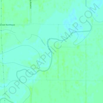
Name: Topografische Karte Forest River, Höhe, Relief.
Ort: Forest River, Walsh County, North Dakota, USA (48.26876 -97.25089 48.27907 -97.23664)
Durchschnittliche Höhe: 245 m
Minimale Höhe: 241 m
Maximale Höhe: 249 m
Andere topografische Karten
Klicken Sie auf eine Karte, um ihre Topografie, ihre Höhe und ihr Relief anzuzeigen.
Lake Sakakawea
Lake Sakakawea, McLean County, North Dakota, USA
Durchschnittliche Höhe: 651 m
Theodore Roosevelt National Park
Theodore Roosevelt National Park, Billings County, North Dakota, USA
Durchschnittliche Höhe: 684 m
Lake Ashtabula
Lake Ashtabula, 15th Street Southeast, Barnes County, North Dakota, 58056, USA
Durchschnittliche Höhe: 423 m
Lake Tschida
Lake Tschida, 56th Street Southwest, Grant County, North Dakota, USA
Durchschnittliche Höhe: 661 m
Rock Lake
USA > North Dakota > Rock Lake
Rock Lake, Towner County, North Dakota, USA
Durchschnittliche Höhe: 472 m
Sheyenne River
Sheyenne River, Nelson County, North Dakota, 58361, USA
Durchschnittliche Höhe: 428 m
General Sibley Park & Campground
General Sibley Park & Campground, Burleigh County, North Dakota, USA
Durchschnittliche Höhe: 498 m
Lake Metigoshe State Park
Lake Metigoshe State Park, Bottineau County, North Dakota, USA
Durchschnittliche Höhe: 660 m
Boundary Lake
Boundary Lake, 23rd Avenue Northeast, Bottineau County, North Dakota, USA
Durchschnittliche Höhe: 685 m
Dunseith
USA > North Dakota > Dunseith
Dunseith, Rolette County, North Dakota, USA
Durchschnittliche Höhe: 521 m