
Topografische Karte Cordeaux Heights
Interaktive Karte
Klicken Sie auf die Karte, um die Höhe anzuzeigen.
Über diese Karte
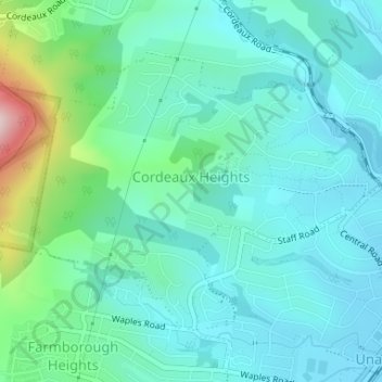
Name: Topografische Karte Cordeaux Heights, Höhe, Relief.
Durchschnittliche Höhe: 92 m
Minimale Höhe: 15 m
Maximale Höhe: 400 m
Andere topografische Karten
Klicken Sie auf eine Karte, um ihre Topografie, ihre Höhe und ihr Relief anzuzeigen.
Flat Rock Junction
Australia > New South Wales > Wollongong City Council > Flat Rock Junction
Durchschnittliche Höhe: 334 m
Mount Kembla
Australia > New South Wales > Wollongong City Council
The summit of Mount Kembla has an elevation of 534 metres (1,752 ft) above sea level.
Durchschnittliche Höhe: 227 m
Glastonbury Gardens
Australia > New South Wales > Wollongong City Council
Durchschnittliche Höhe: 73 m
Sublime Point Lookout
Australia > New South Wales > Wollongong City Council
Durchschnittliche Höhe: 220 m