
Topografische Karte Tordesillas
Interaktive Karte
Klicken Sie auf die Karte, um die Höhe anzuzeigen.
Über diese Karte
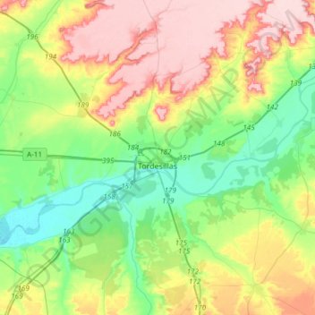
Name: Topografische Karte Tordesillas, Höhe, Relief.
Ort: Tordesillas, Valladolid, Castile and León, Spain (41.45174 -5.15666 41.56136 -4.85842)
Durchschnittliche Höhe: 733 m
Minimale Höhe: 659 m
Maximale Höhe: 845 m
Tordesillas (Spanish pronunciation: ) is a town and municipality in the province of Valladolid, Castile and León, central Spain. It is located 25 kilometres (16 mi) southwest of the provincial capital, Valladolid at an elevation of 704 metres (2,310 ft). The population was c. 9,000 as of 2009.