
Topografische Karte Tug Hill
Interaktive Karte
Klicken Sie auf die Karte, um die Höhe anzuzeigen.
Über diese Karte
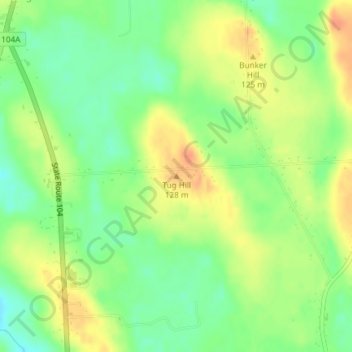
Name: Topografische Karte Tug Hill, Höhe, Relief.
Durchschnittliche Höhe: 109 m
Minimale Höhe: 89 m
Maximale Höhe: 129 m
The core Tug Hill region encompasses 150,000 acres (610 km2) of unbroken, generally second-growth, northern hardwood forest, and is drained by a vast network of streams. Important rivers and streams whose headwaters are located within the Tug Hill region include the Mohawk River, Deer River, Salmon River, Mad River, Sandy Creek, and the east and west branches of Fish Creek. Despite the presence of numerous streams, many of the soils in the regions' core are poorly drained. Almost all the soils have some combination of factors which render them unsuitable for agriculture, including shallow depth, stoniness, rough topography, poor or excessive drainage, strong acidity and/or low fertility. Agricultural activity is largely absent from the Tug Hill's core, and is concentrated mainly in the outlying northern and western portions of the region, where soils are better drained and more fertile.