
Topografische Karte Stanthorpe
Interaktive Karte
Klicken Sie auf die Karte, um die Höhe anzuzeigen.
Stanthorpe
Owing to its elevation, Stanthorpe features a subtropical highland climate. At an altitude of 811 metres (2,661 ft), Stanthorpe holds the record for the lowest temperature recorded in Queensland at −10.6 °C (12.9 °F) on 23 June 1961. Sleet and light snowfalls are occasionally recorded, with the most significant snowfall in over 30 years occurring on 17 July 2015.
Über diese Karte
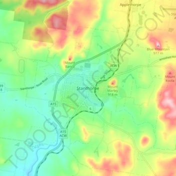
Name: Topografische Karte Stanthorpe, Höhe, Relief.
Durchschnittliche Höhe: 840 m
Minimale Höhe: 760 m
Maximale Höhe: 966 m