
Topografische Karte Prescott Valley
Interaktive Karte
Klicken Sie auf die Karte, um die Höhe anzuzeigen.
Über diese Karte
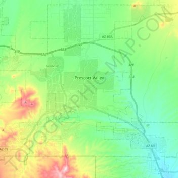
Name: Topografische Karte Prescott Valley, Höhe, Relief.
Durchschnittliche Höhe: 1.550 m
Minimale Höhe: 1.378 m
Maximale Höhe: 1.972 m
Prescott Valley (locally, PV) is located in central Arizona approximately 85 miles (137 km) north of Phoenix at 5,100 feet (1,600 m). elevation. PV has good access to Arizona State Route 89, SR-89A and SR-69, connecting to Interstates 17 and 40. Air service is available at Ernest A. Love Field, about 8 miles (13 km) northwest.