
Topografische Karte Kothagudem
Interaktive Karte
Klicken Sie auf die Karte, um die Höhe anzuzeigen.
Über diese Karte
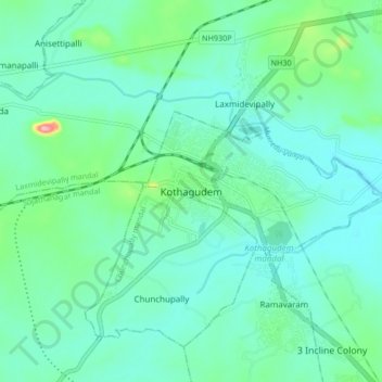
Name: Topografische Karte Kothagudem, Höhe, Relief.
Durchschnittliche Höhe: 109 m
Minimale Höhe: 81 m
Maximale Höhe: 230 m
Kothagudem is located at 17°33′00″N 80°37′05″E / 17.55°N 80.618°E / 17.55; 80.618. It has an average elevation of 89 metres (295 ft) above sea level. The North of Kothagudem borders Chhattisgarh state which is approximately 120 km from the town.