
Topografische Karte Rotonda
Interaktive Karte
Klicken Sie auf die Karte, um die Höhe anzuzeigen.
Über diese Karte
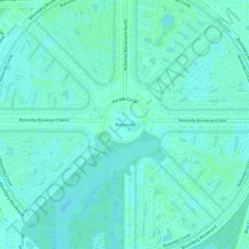
Name: Topografische Karte Rotonda, Höhe, Relief.
Ort: Rotonda, Charlotte County, Florida, 33947, United States (26.87195 -82.29239 26.91195 -82.25239)
Durchschnittliche Höhe: 4 m
Minimale Höhe: 1 m
Maximale Höhe: 6 m
Andere topografische Karten
Klicken Sie auf eine Karte, um ihre Topografie, ihre Höhe und ihr Relief anzuzeigen.
Punta Gorda
United States > Florida > Charlotte County
Punta Gorda features a predominantly flat topography characterized by its low elevation, averaging around 7 to 10 feet above sea level. The terrain is primarily made up of coastal plains and wetlands, interspersed with small hills such as those found in South Punta Gorda Heights, which can reach elevations of…
Durchschnittliche Höhe: 3 m
Port Charlotte
United States > Florida > Charlotte County
Port Charlotte is characterized by a predominantly flat and low-lying terrain, typical of Florida’s coastal landscape. The area features a network of waterways, including the Peace River and Charlotte Harbor, which provide ample opportunities for recreational activities like boating and fishing. Elevations…
Durchschnittliche Höhe: 4 m
South Gulf Cove Park
United States > Florida > Charlotte County > Port Charlotte
Durchschnittliche Höhe: 3 m
South Gulf Cove Park
United States > Florida > Charlotte County > Port Charlotte
Durchschnittliche Höhe: 3 m
Heritage Lake Park Community Development District
United States > Florida > Charlotte County
Durchschnittliche Höhe: 7 m
Peace River Preserve
United States > Florida > Charlotte County > Punta Gorda > Harbour Heights
Durchschnittliche Höhe: 3 m
Harbour Heights
United States > Florida > Charlotte County > Punta Gorda > Harbour Heights
Durchschnittliche Höhe: 4 m
Port Charlotte
United States > Florida > Charlotte County > Port Charlotte
Durchschnittliche Höhe: 4 m
Gilcrest Park
United States > Florida > Charlotte County > Punta Gorda > Fishermens Village
Durchschnittliche Höhe: 2 m