
Topografische Karte Thousand Islands National Park (Mallorytown Landing)
Interaktive Karte
Klicken Sie auf die Karte, um die Höhe anzuzeigen.
Über diese Karte
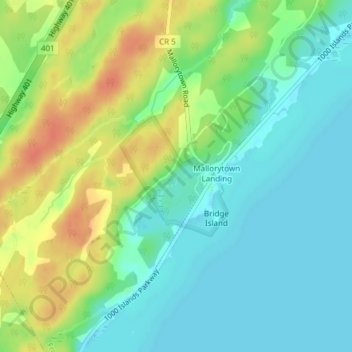
Name: Topografische Karte Thousand Islands National Park (Mallorytown Landing), Höhe, Relief.
Durchschnittliche Höhe: 89 m
Minimale Höhe: 72 m
Maximale Höhe: 116 m