
Topografische Karte Kalimpong
Interaktive Karte
Klicken Sie auf die Karte, um die Höhe anzuzeigen.
Kalimpong
Kalimpong is a city and a municipality in the Indian state of West Bengal. It is located at an average elevation of 1,250 metres (4,101 ft). The city is the headquarters of the Kalimpong district. Kalimpong district region comes under Gorkhaland Territorial Administration which is an autonomous governing body within the state of West Bengal. The Indian Army's 27 Mountain Division is located on the outskirts of the city.
Über diese Karte
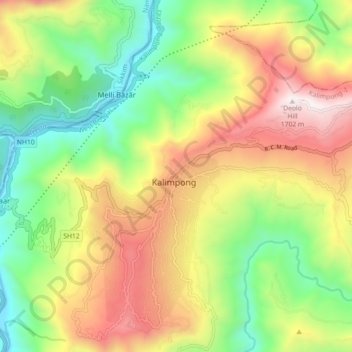
Name: Topografische Karte Kalimpong, Höhe, Relief.
Ort: Kalimpong, Kalimpong -I, Kalimpong, West Bengal, 734301, India (27.03169 88.43290 27.11169 88.51290)
Durchschnittliche Höhe: 838 m
Minimale Höhe: 196 m
Maximale Höhe: 1.683 m