
Topografische Karte Dandeli
Interaktive Karte
Klicken Sie auf die Karte, um die Höhe anzuzeigen.
Über diese Karte
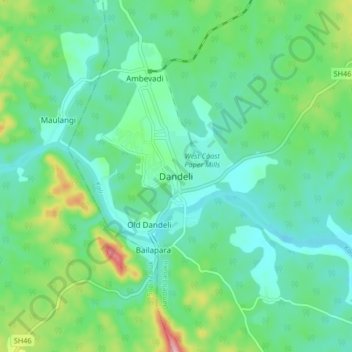
Name: Topografische Karte Dandeli, Höhe, Relief.
Durchschnittliche Höhe: 480 m
Minimale Höhe: 433 m
Maximale Höhe: 623 m
Dandeli is located at 15.247719N, 74.629678W. It has an average elevation of 473 metres (1,552 ft) and has received heavy rainfall during August to November (see chart below). Because of good forest cover and moderate elevation, the location has a tropical highland climate, averaging about 27 °C (81 °F) in summer and 18 °C (64 °F) in winter.