
Topografische Karte Lake Houston
Interaktive Karte
Klicken Sie auf die Karte, um die Höhe anzuzeigen.
Über diese Karte
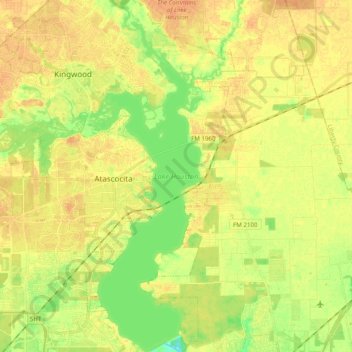
Name: Topografische Karte Lake Houston, Höhe, Relief.
Durchschnittliche Höhe: 20 m
Minimale Höhe: 2 m
Maximale Höhe: 31 m
Andere topografische Karten
Klicken Sie auf eine Karte, um ihre Topografie, ihre Höhe und ihr Relief anzuzeigen.
Rummel Creek
Rummel Creek, Houston, Harris County, Texas, TX 77043, USA
Durchschnittliche Höhe: 28 m
Alligator Alley
Alligator Alley, Houston, Harris County, Texas, 773345, USA
Durchschnittliche Höhe: 20 m
Battleship Texas State Historic Park
Battleship Texas State Historic Park, Houston, Harris County, Texas, USA
Durchschnittliche Höhe: 3 m
Edith L. Moore Nature Sanctuary
Edith L. Moore Nature Sanctuary, Houston, Harris County, Texas, USA
Durchschnittliche Höhe: 26 m