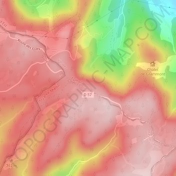
Topografische Karte L'Étang Noir
Interaktive Karte
Klicken Sie auf die Karte, um die Höhe anzuzeigen.
Über diese Karte
Name: Topografische Karte L'Étang Noir, Höhe, Relief.
Durchschnittliche Höhe: 693 m
Minimale Höhe: 487 m
Maximale Höhe: 778 m

Klicken Sie auf die Karte, um die Höhe anzuzeigen.
Name: Topografische Karte L'Étang Noir, Höhe, Relief.
Durchschnittliche Höhe: 693 m
Minimale Höhe: 487 m
Maximale Höhe: 778 m