
Topografische Karte Suratgarh
Interaktive Karte
Klicken Sie auf die Karte, um die Höhe anzuzeigen.
Über diese Karte
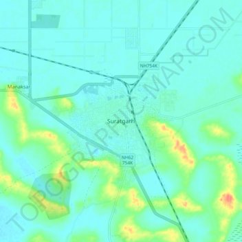
Name: Topografische Karte Suratgarh, Höhe, Relief.
Durchschnittliche Höhe: 177 m
Minimale Höhe: 167 m
Maximale Höhe: 217 m
Suratgarh is located at 29°19′04″N 73°53′56″E / 29.317701°N 73.898935°E / 29.317701; 73.898935. It has an average elevation of 168 metres (551) feet. It is a Northern Part of Thar desert. Seasonal Ghaghar river runs through Northern part of tehsil. Suratgarh has Greenary in Northern part and Desert called tibba in southern part. From tibbas near Hanuman khejri and Manaksar this difference can be seen.