
Topografische Karte Portugal Cove - St. Philips
Interaktive Karte
Klicken Sie auf die Karte, um die Höhe anzuzeigen.
Über diese Karte
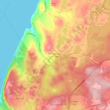
Name: Topografische Karte Portugal Cove - St. Philips, Höhe, Relief.
Durchschnittliche Höhe: 128 m
Minimale Höhe: 0 m
Maximale Höhe: 228 m