
Topografische Karte Sétif
Interaktive Karte
Klicken Sie auf die Karte, um die Höhe anzuzeigen.
Über diese Karte
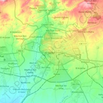
Name: Topografische Karte Sétif, Höhe, Relief.
Ort: Sétif, Daïra Sétif, Sétif (Provinz), Algerien (36.13356 5.33706 36.24869 5.50629)
Durchschnittliche Höhe: 1.069 m
Minimale Höhe: 937 m
Maximale Höhe: 1.291 m