
Topografische Karte Luwin
Interaktive Karte
Klicken Sie auf die Karte, um die Höhe anzuzeigen.
Luwin
Livigno befindet sich auf einer Höhe von 1816 m s.l.m. in den Livigno-Alpen und ist ein beliebter Wintersportort. Es liegt am Fluss Spöl (heute auch auf Italienisch so, früher Aqua Granda), der das Livigno-Tal von Süden nach Norden durchfließt, mit einem Damm an der italienisch-schweizerischen Grenze zum Lago di Livigno gestaut wird und danach bei Zernez im Engadin in den Inn und damit in die Donau mündet. Das Tal liegt also nördlich der Wasserscheide der Alpen.
Über diese Karte
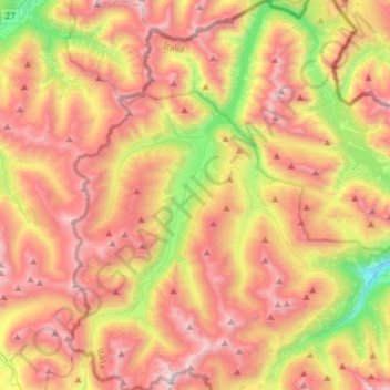
Name: Topografische Karte Luwin, Höhe, Relief.
Durchschnittliche Höhe: 2.388 m
Minimale Höhe: 1.412 m
Maximale Höhe: 3.255 m
Andere topografische Karten
Klicken Sie auf eine Karte, um ihre Topografie, ihre Höhe und ihr Relief anzuzeigen.
Piz Cengalo
Italien > Lombardei > Sondrio > Val Masino
Der Höhenweg Vial zwischen Sasc-Furä- und Sciorahütte, der die Cengalo-Nordflanke quert, ist seit dem Bergsturz von 2017 verschüttet. Der Weg war schon vorher wegen hoher Steinschlaggefahr gesperrt, konnte aber bis 2017 auf eigene Gefahr begangen werden.
Durchschnittliche Höhe: 2.657 m
Gaviapass
Italien > Lombardei > Sondrio > Valfurva
Der Gaviapass liegt im Nationalpark Stilfserjoch und verbindet Bormio im Norden mit Ponte di Legno im Süden über eine 43 km lange Passstraße (SS300, bis April 2021 SP29 in Sondrio, SP BS 300 in Brescia). Auf der Nordrampe sind zehn Kehren bis zur 2621 m s.l.m. hoch gelegenen Passhöhe zu durchfahren, auf…
Durchschnittliche Höhe: 2.659 m
Cima de' Piazzi
Italien > Lombardei > Sondrio > Valdidentro
Der Berg liegt zwischen dem Valle Grosina, dem Valdisotto und dem Valdidentro. Sie besteht aus drei Bergkämmen, wobei der westnordwestliche und der nordöstliche am Gipfel zusammenlaufen. Die beiden Kämme umschließen die vergletscherte Nordseite des Berges. Der Südkamm zweigt etwas östlich des Gipfels ab…
Durchschnittliche Höhe: 2.802 m