
Topografische Karte Eyjafjallajökull
Interaktive Karte
Klicken Sie auf die Karte, um die Höhe anzuzeigen.
Eyjafjallajökull
Er liegt an der äußersten Südküste, westlich des Gletschers Mýrdalsjökull in der Gemeinde Rangárþing eystra, die größte Höhe beträgt 1651 m. Unter dem Gletscher befindet sich der Vulkan mit eigener Magmakammer, der seit der Besiedelung von Island in den Jahren 920, 1612 (oder 1613), 1821 bis 1823 und zuletzt im Jahr 2010 aktiv war.
Über diese Karte
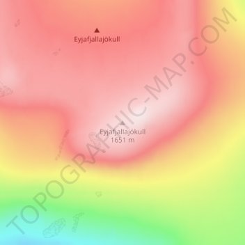
Name: Topografische Karte Eyjafjallajökull, Höhe, Relief.
Ort: Eyjafjallajökull, Rangárþing eystra, Suðurland, Island (63.61974 -19.61510 63.61984 -19.61500)
Durchschnittliche Höhe: 1.459 m
Minimale Höhe: 1.162 m
Maximale Höhe: 1.628 m