
Topografische Karte Kayseri
Interaktive Karte
Klicken Sie auf die Karte, um die Höhe anzuzeigen.
Kayseri
Kayseri liegt in 1054 m Seehöhe am Fuße des erloschenen Vulkanes Erciyes (3916 m), der die Tuffsteinschichten in Kappadokien verursachte.
Über diese Karte
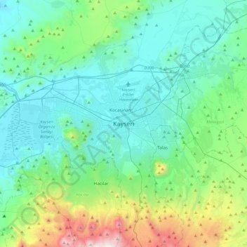
Name: Topografische Karte Kayseri, Höhe, Relief.
Ort: Kayseri, Melikgazi, Kayseri, Zentralanatolien, 38015, Türkei (38.56190 35.32732 38.88190 35.64732)
Durchschnittliche Höhe: 1.345 m
Minimale Höhe: 1.013 m
Maximale Höhe: 2.795 m