
Topografische Karte Parque Arqueológico Nacional de Pisaq
Interaktive Karte
Klicken Sie auf die Karte, um die Höhe anzuzeigen.
Über diese Karte
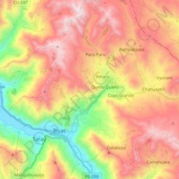
Name: Topografische Karte Parque Arqueológico Nacional de Pisaq, Höhe, Relief.
Durchschnittliche Höhe: 3.848 m
Minimale Höhe: 2.944 m
Maximale Höhe: 4.667 m